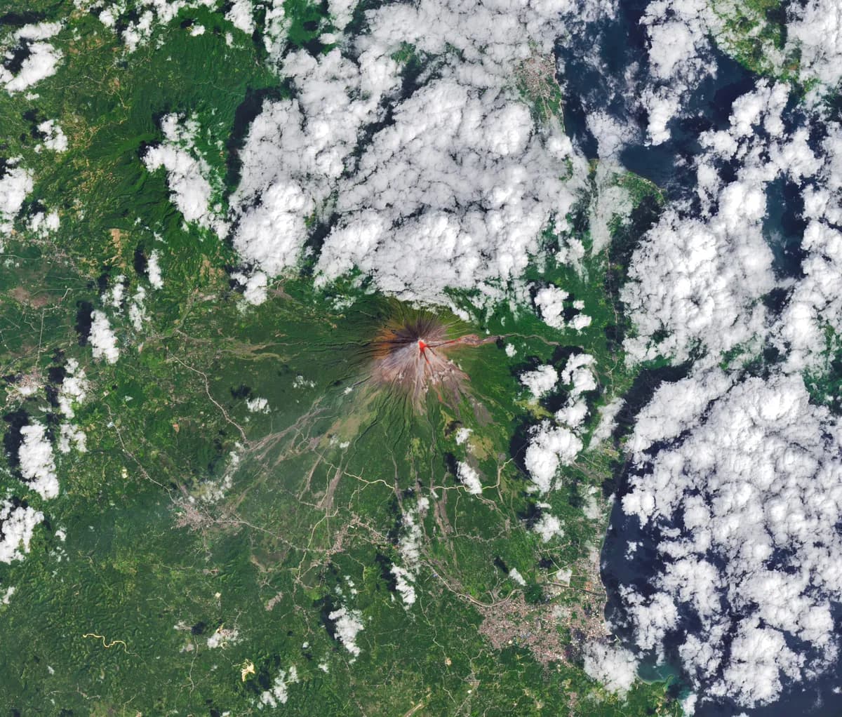
According to NASA, the Operational Land Imager (OLI) on Landsat 8 acquired a rare, relatively clear image of Mayon volcano on February 26, 2026. Mayon is the most active volcano in the Philippines. The natural-color scene is overlaid with infrared observations to highlight the lava's heat signature.
On February 26, 2026, the Philippine Institute of Volcanology and Seismology (PHIVOLCS) reported volcanic earthquakes, rockfalls, and pyroclastic flows (hot clouds of ash and debris). Multiple NASA satellites monitored Mayon volcano's sulfur dioxide emissions. NASA satellites showed sizable plumes of sulfur dioxide gas drifting southwest on February 4 and March 6.
The current alert level or eruption status of Mayon volcano has not been specified. Specific impacts or damage caused by the volcanic activity remain unclear. The volume or intensity of the sulfur dioxide emissions detected has not been detailed.