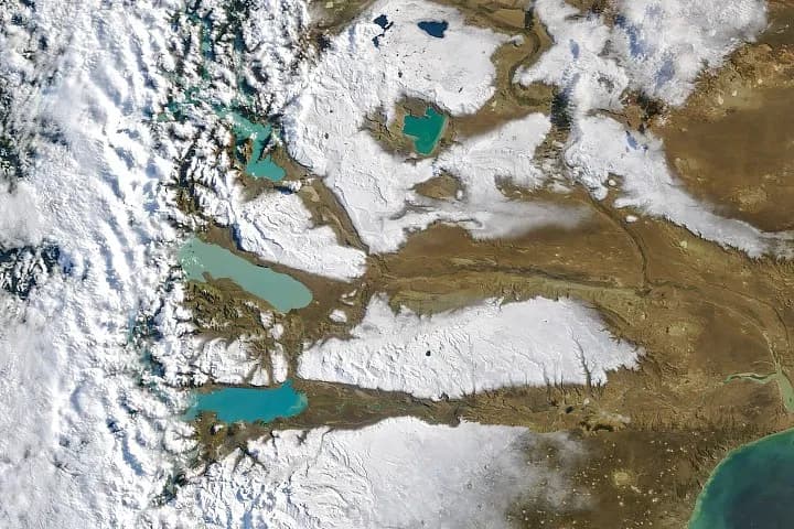
The MODIS on NASA's Terra satellite captured an image of the snowy Patagonian Desert on the morning of April 3, 2026, following the storm. Early fall has been wetter than normal in southern Patagonia, with satellite-based estimates showing above-average precipitation from late March through early April 2026, according to René Garreaud, an atmospheric scientist at Universidad de Chile. Much of the region's precipitation tends to fall on the western, windward side of the Andes, Garreaud noted, but strong winds can blow some snow east into the Argentinian side.
In the satellite view, snow clings to the higher elevations, while valleys draining the large glacial lakes are bare. A stark snow line appears along the outlet of Lago Argentino in a detailed Landsat image. Lago Argentino and other nearby lakes contain an abundance of fine sediment, or glacial flour, pulverized by southern Patagonia's plentiful glaciers, making them appear milky blue or turquoise.
By the afternoon of April 4, 2026, a satellite view showed that snow had melted from all but the highest mountain areas. The cause of the storm and the amount of snow that fell remain unclear, as do the specific impacts on local communities or ecosystems and how this precipitation compares historically. Long-term climate implications of such events in Patagonia are also not yet determined.