NISAR's 39-foot antenna reflector provides high-detail data on how a region's surface and natural resources are changing. The radar works by sending signals toward Earth's surface, which reflect off the ground back to the spacecraft in a phenomenon called backscatter. By measuring changes in the reflected signal, scientists can identify surface properties like moisture, vegetation, and terrain variations.
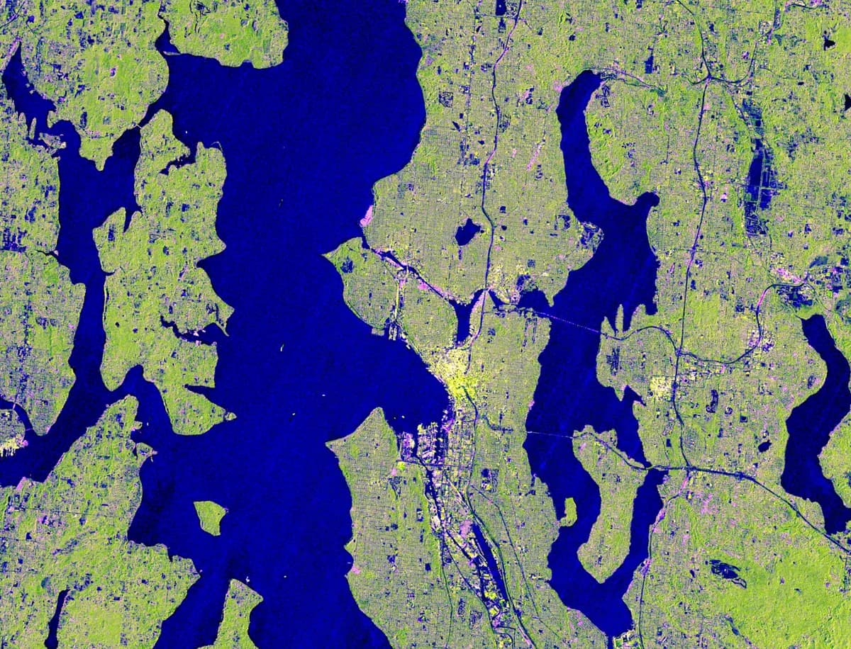
Radar images do not capture true color like photographs; instead, colors represent different combinations and intensities of radar signals or their polarization. Imagery from November 10, 2025, shows waterways around Portland and Seattle, with roadways and cityscapes built alongside them. In these images, magenta areas result from radar signals strongly reflecting off flat surfaces such as roads and buildings, while yellow areas may be produced by factors including land cover, soil moisture, and surface geometry.
Yellow-green indicates forests and wetlands covering the region, and dark blue peaks represent Mount Rainier and Mount Saint Helens. Comparing highly detailed NISAR imagery over time can reveal subtle changes in forests, wetlands, urban areas, and infrastructure. Radar images from NISAR can detect subtle motions associated with volcanic activity, glacier movement, slips along faults, and slow-moving landslides.
With radar images, scientists can look for changes in backscatter over time to tell where trees and plants have been removed, regrown, or destroyed, and to estimate how much carbon is stored in forests. Monitoring the boundaries of water and wetlands provides insight into flood risks or shifts in river channels. The Pacific Northwest is home to millions of people and supports major industries from tech and aerospace to agriculture and forestry.